Dalton Highway, aka The Haul Road
(intermittent internet service is postponing our posts to the blog 🙂
August 28-Sept. 2
This road was built for one purpose only- the Trans- Aleyska Pipeline. Oil was discovered in Prudhoe Bay in 1968- remember the oil crisis back then? A consortium of oil companies working with the federal and state governments planned and built a 438 mile road and a 800+ mile pipeline to bring oil from Prudhoe Bay to Valdez to be shipped out.


The road was built in FIVE months. The pipeline took only took 3 years, finished in 1974.


Back to the road-from Livengood to Deadhorse it is for trucking, and it was not open to the public until the 80s, and then only to Coldfoot, and in the 90s opened all the way to Deadhorse. The trucks have the right of was- always.


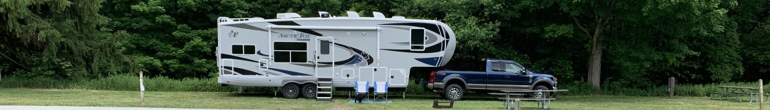
The posted speed limit is 50mph. The road is gravel, pavement, tar and gravel, and every combination of those. It was great in some areas- 50mph with the camper in, in others 20mph was a stretch. Services are VERY limited on this road- fuel in three places over 438 miles (with the possibility of NO low sulpher fuel at Deadhorse), two “camps” with a cafe, workcamp lodging and fuel, 3 BLM campgrounds, no repair services. Deadhorse is an oil camp with a couple of workcamp hotels. And you can NOT get to the Artic Ocean (the reason most people drive those last 200 miles) without taking a tourist excursion 8 miles beyond the Oil Camp. We have heard- you MUST do it, or it is pointless to go that far….we did not.
So, why drive it? It is the easiest way to drive to the Artic Circle- mile 115 on the Dalton Highway.  And above that? well, it is only what becomes you in this truly desolate remote area of Alaska. We decided to take the camper as far as Coldfoot, and then drive just the truck up through Atigan Pass as far as the beginning of the North Slope and the artic tundra.
The views are spectacular, the road too, but in a very different way. Fortunately, this late in the season there were fewer private vehicles and rvs out here, and autumn has started here, so the colors are beautiful.


We had wet weather the first two days driving- the camper and truck were covered with mud- on some places 3 inches thick!


The day we drove in just the truck further north was rainy and then….snowy…and cold…we went down to 26 degrees! and the day never got over 35- 26 degress at the Pass at noon time! From before Atigun Pass through the next 45 miles everything was white- we saw the Arctic Tundra,


but it was white- several inches of snow had fallen overnight and flurries chased us all day. Too cold and wet to hike.


And then it cleared, back at Marion Campground, mile 160, it was sunny but cold, which meant possible Northern Light Viewing. So, I got up at 1:30am and there they were! Not very colorful, but vivid and in motion across a large area of the sky.
Headed back out, knowing it was a long bumpy drive we planned to stop and hike a couple of times. Once at South Koyukuk River- supposed to be good gold panning here, but it was TOO cold, although we did see a couple of air boats come in from down river. Finger Mtn was a great rest area-


an interpretive walk describes the plant, animal and geologic life here. These boulders are big versions of the frost heaves in Maine roads in the spring!


We hiked across lots of these rocks on a trail that really wasn’t a trail out to Finger Rock- this rocks points towards Fairbanks!
Mythbuster – Alaska is NOT teeming with wildlife- yes we saw a lot in Denali NP, but we have seen very little elsewhere in the state. Alaska has massive areas of preserved land- most of the land north of Fairbanks. In our 20 hours, 600 miles of the Dalton Highway we saw- 2 mooose (twice, 4 hours later they were still in the same pond feeding), 2 ptarmigan, a ground squirrel an eagle, ravens and an Silver Fox- which is very rare.


This land is so sparse in vegetation that animals need a lot of acreage to survive here.
