Category: Uncategorized
Virginia
Early April
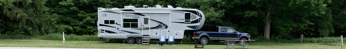
There are very few campgrounds coming back across the Appalachians, and even fewer open this time of year. The National Forest Service land in the east has organized campgrounds sporadically through the forests, but not like the dispersed camping out west. Plus, they got 16″ of snow 10 days ago and that downed a lot of trees and branches, so we found ourselves at a small private campground that was very sweet.
Rt. 52 used to be “the road” from Chicago to Florida back before the interstates existed. Up the road from the campground was Big Walker Mountain Country Store and Lookout-  the lookout is a 100 ft steel lookout tower that you pay to walk up for the awesome view(that is Clare at the top…and me at the bottom taking thepic:-).
 It was built by the current owner’s grandfather in the 1940s as a “tourist trap”. The road is twisty and turny and goes up and down- can you imagine making your way to Florida on that road?
A three day stop at Occoneechee State Park and we finally had a 70 degree sunny day- hike and hung out in the sunshine- the next day was cold and rainy with snow expected overnight. Say what? It is April in the south- snow??
Kentucky and Woodford
April, 2018
There is a lot of history here- Daniel Boone and the Cumberland Gap. We stayed at Fort Boonesboro State Park, which is the site of Boone’s settlement in 1775 and the end of the Wilderness Road. The Kentucky River which eventually flows to the Mississippi was an instrumental part of moving goods and important during the Civil War. However, the State Park people seem to little care about their rich history.
We toured Woodford Reserve Distillery (our preferred whiskey choice:-) The site is the oldest, continually operating distillery in the US- starting in 1838. It has had several owners, and was shuttered during Prohibition, however they still distill in the original buildings the same old way- huge vats for fermenting the mash, 3 copper pot stills for distilling the bourbon, and oak barrels- “toasted” and charred. The tour was fascinating and informative and we had a tasting of the Woodford Reserve and the Woodford Double Oaked, paired with Woodford Bourbon Chocolate. There are 200 separate flavors in Woodford Reserve! One reason the Kentucky Bourbon Whiskey is so special is the high calcium water without sulphites (which also, supposedly is what makes the great race horses from this area).


We have also seen some of the deepest poverty yet on our travels- several hundred miles through eastern Kentucky. In this part of the state there seems to be little industry, business or tourism. And even in the Bluegrass area with all it’s huge racing horse farms and stables, that prosperity seemed to be very localized and for the select few- someone has to muck out all those stalls.
Tennessee and Cumberland Gap
Late March?
Tennessee
Back roads…did I say, twisty, turny, narrow back roads? Through the back woods and small towns, some rather dilapidated. So, of course, I just had to find Dueling Banjos from Deliverance to play off my phone. I thought Clare was going right into the ditch! Of course, the ditch was only inches from the tires- the roads were amazingly narrow with no shoulder to speak of- just straight to the deep ditch. We did manage to stay on the road.
We frequently seem to be going “cross-grain” to the way the majority of roads go, and we avoid interstates as much as possible, so sometimes our road choices are a bit sketchy.
Cumberland Gap
What a fascinating place! This is where settlers passed through to get from the east of the Appalachian Mtns. to the west. Daniel Boone blazed the trail in 1775. Settlers from as far north as Pennsylvania would travel south until they got near here and then travel across the mountains through this gap to what is now Kentucky. The tiny town of Cumberland Gap is in an ancient meteorite crater!
And in a serendipitous way, our next stops are at Levi Jackson State Park – an early settler and trader, and Fort Boonesborough where Boone, his family and others from his party settled.
The Wilderness Trail and Boone Trace are actually parts of the roads and highways here, as well as hiking trails. It is interesting to think about what the settlers saw and experienced when they first traveled these lands.
The Great Smokies
Late March, 2018
The Great Smokies
After many weeks at sealevel and mostly straight roads, we are again up and down in elevation on narrow little mountain roads (yes, numbered state routes) with some corners that we barely fit around without crossing the yellow line. About 3,000 ft in elevation. The weather has been cool and overcast- in fact much of the Blue Ridge Parkway has been closed, as wall as the road through the Smokies the other day. We are at the southern most campground in the Smokies. We did a little hike today- had to cross some creeks on log bridges- check out Dear Diary for Rhylee’s “fun” on this hike 🙂
Our ride over the Smokies on Newfound Gap Rd. was rather uneventful as it was all fogged in.
And then a night in the Cracker Barrel parking lot, after driving through 10 miles of tourist “attractions” and strip malls on a 6 lane highway!
South Carolina
March…
We traveled a twisty, turny road between the mountains to Oconee State Park…why? because it is SNOWING north of us, and we need to bide our time…or go east…or wait…
Over to Oconee State Park- waterfalls, hiking and scenery, however very cool and overcast.


Lots of wildflowers in bloom along this hike to Station Cove Falls. And one type of flower- the Oconee Bell- is endangered, only found in Oconee County, and the campground had one patch, fenced off, of course- the lower right pic.


North Georgia
March….. 2018
We are at the bottom of the Appalachian Mtns., in fact the “Trail” starts just a short ways from here at Springer Mountain. And there is “gold in these hills”, which is partly why we are here.
The very first Gold Rush in American happened here, in the 1830s, and ended quickly when the California Gold Rush in 1849 enticed every prospecter here to go west. We toured the oldest gold mine in the area and panned for gold- lots of fun and very informative. We were given pans and panned over a water trough in a roofed over building- a great tourist spot, but now quite the real thing. We also went to another gold mine, this one still crushes rock from their mine for us to pan. And we were also given two buckets of sand “seeded” with gemstones from Franklin River in North Carolina to sift through- and lo and behold we had about a dozen different types of gemstones, a couple actually have jewelry value- a piece of ruby and one of emerald- so we are having them cut into small stones, neither one of them looked like anything other than pretty rocks!

This area is now a tourist center- cooler in the summer in the mountains, very scenic, lots of new vineyards and winerys and a small “alpine village”- Helen. We walked up to Ruby Falls- a steep but paved half mile trek to beautiful falls.
Apparently, not only do we not know the date, but we were also to busy to take any photos of us panning for gold or visiting the quaint towns of Helen and Dahlonega…:-) This one is of cherry blossoms at the North Georgia University.
Headed North by Northeast
March
We’re headed back to Maine, slowly by surely. Hills, farm fields, small towns, rivers, and mountianss. Quite the change from 3 months on the very flat Gulf Coast! Wild flowers are starting to bloom, trees are budded out, some almost leafed out. The weather is cool, but clear and dry. Very little boondock camping in the east so State Parks are our future.
FD Roosevelt State Park, GA- an amazing place.


This area is where FDR came for the spring waters and started a treatment center for people with polio. Pine Mountain is a 20+ mile ridge- great views now, but once the leaves are out, not so much.
We “sprung ahead” last weekend, and this week we moved into the very western side of the Eastern Time Zone with Daylight Savings Time- WOW! Sunrise today was at 7:47am- so hard to get moving in the morning, however sunset was at 7:45pm- almost 12 hours of daylight. Moving in, out and across time zones, as well as north to south, and through the seasons, has been fascinating for both of us to watch sunrise/sunset times change and the length of daylight change.
Fort Mountain State Park, Georgia- first time we have been in elevation – 2500ft.- since last December! This campground is partway up a mountain in the foothills of the Applachians. The sites are terraced around a small lake. There is great history here- the CCC built much of this park, including a stone firetower at the top of the mountain.


Along the south perimeter of the peak there is a 855 ft long stone wall, 6 feet high and about 4 ft wide which was built about 450ad,


and no one knows exactly why- it does not appear to be for defensive, or a fence or even ceremonial…there are several similar ones within this region…history mystery!
Destin, FL
Mid-March
Truly beautiful, sugar sand white beaches, crystal clear water with the classic Caribbean blue/green colors.  Paradise, right? Not so much. Everyplace has it’s down side. We are on a narrow barrier island with a 6 lane highway down the middle. Except for this mile strip of Henderson Beach State Park, all the rest of the beach and sound sides are built up. We can see 5 multi-story condos/apts/hotels in one direction and 10 the other way. The highway is almost one continuous strip mall interspersed with tourist traps.
A nice day for stunt kite flying:


Waffle Houses are everywhere down here! Every 5 miles or so, which meant we just had to stop at one, just to say we did…breakfast was okay, watching people was more fun! Also, we have started to see Dunkin Donuts shops and Panera Bread; stores we haven’t seen since we crossed the Mississippi River going the other way.
For those of you that have asked about Derek- he is currently back in Jordan on security duty; he has racked up thousands of miles as they have moved him all over the middle east. He is healthy and seems happy. And he has just earned the rank of Sergeant. Please keep him in your thoughts.
MS and AL
Early March, 2018
Mississippi
Miles and miles of white sandy beach- amazing! Sugar sand, for sure. It was lovely to walk barefoot in; very different than any other beach we have walked. The coast of Mississippi is very touristy, but quaint and not tacky at all- probably very expensive to live or visit here.
We are camping at Gulf Shore National Seashore in Ocean Springs, next to Biloxi. Davis Bayou is very different than the Louisianna bayous- the campground is on a knoll surrounded by bayou channels through salt marsh with the barrier reef just off shore.


And, lots of plants flowering- spring in the south. Azaleas grow wild here. Magnolia trees grow to 30ft- too early for them to be in bloom here.
Alabama
Get this…as we were driving through Alabama, guess what song came on the radio—yup- Sweet Home Alabama! What a hoot!
Dauphin Island – a “best kept secret” kind of place- on the Gulf of Mexico at the bottom of Mobile Bay. A sandy barrier island with real trees, beautiful beaches and a very small, quaint community. A long drive down to the island or a ferry ride across the bay are the access points, and seem to keep this place fairly quiet.
We could walk to the beach, wander through a bird sanctuary, head over to the bay side, or visit Fort Gaines all on foot. As a Northerner, I guess I have pretty much ignored and/or forgotten the South’s history, so these forts offer great information about the Civil War along the Gulf Coast. “Damn the torpedoes and full speed ahead” was said by Admiral Farragut, as a floating sea mine blew up one of his ships heading into Mobile Bay. Once the one “torpedo” was gone a clear safe channel was open to the rest of his fleet and a huge sea battle proceeded in Mobile Bay, with the North winning.
Playing Tourist in the Big Easy!
Feb., 28, 2018
Yup. we’re in New Orleans! At a state park on the West Bank just a few miles from NOLA. We drive to Algiers Point and then take a short pedestrian ferry over to the French Quarter.
Hummm…the French Quarter, well it definitely is worth the visit- lots of great architecture, history and food, however (as we had been warned) it stinks- literally.


Cobblestoned streets, lots of bars, full restaurant trash bins, and outside street drinking apparently makes it smell. Most businesses were hosing down their sidewalks, but we could smell the beer and garbage…for blocks and blocks as we walked much of the French Quarter.
Our first stop was Cafe du Mond- world famous for it’s Beignets- fried dough. It considers itself the first coffee shop. Lots of “firsts” here in New Orleans- we had lunch in the first apartment building in America- built in 1850 by a wealthy woman for wealthy tenants right beside Jackson Square Park. Great Food!


The levees are interesting- because the Mississippi has many oxbows in it, and Lake Pontchartrain is to the north and the Bayou to the west (and most everywhere else) water is everywhere, so levees are everywhere. Many times you are right beside a river, yet have a 10ft. earth levee with a 10 ft wall on top of it.
We went on the Creole Queen Paddlewheel Riverboat- down the river to Chalmette Battlefield which was the site of the last great battle of the War of 1812. The trip was narrated by a gentleman with a great deep voice, who told us the history of New Orleans, about the Battle and the inside story of Hurricane Katrina.


At the Battlefield a Park Service Ranger gave us the details of the battle- 3000 rag tag militia and local troops beat back 12,000 British troops.
RIght now the floodwaters from the mid-west storms are pouring down the Mississippi- which is 2300 miles long, and drains almost half of the US through it’s watershed. It takes about 90 days for water to flow all the way from the headwaters at Lake Itasca, MN.
Hot and humid here; we can’t imagine what it must feel like in the summer here!
We went on an airboat swamp tour out into the Segnette Bayou. Lots of birds, turtles, and alligators- we even got to hold this one- she is about 4 years old.


US News and World Report recently ranked the states and lo and behold, Louisianna ranked the 50th as a place to live. And from the little we saw of Louisianna, we would have to agree. The majority of communities along the coast are poor, very poor. And the roads- highways and city streets are horrible.
